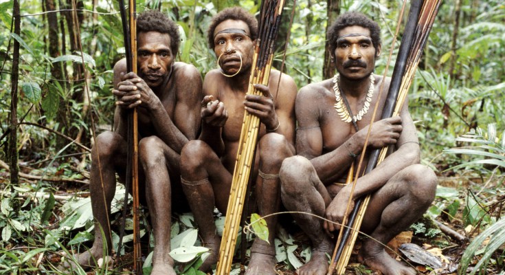
The forests of Papua in Indonesia have been referred to as a last frontier, and those that live in and around them are instrumental in their future. Clarifying and codifying rights to tenure and management may be the key to keeping these forests standing.

Papua’s deforestation and forest degradation rates are below the national average, and these areas contain around half of Indonesia’s primary forests. This translates to the encouraging reality that Papua is largely preserving its forests, and indigenous communities play a big role in this paradigm. However, the tides of change are inevitable and recognising land and tenure rights while engaging communities in forest management is seen as the best way to maintain these amazing landscapes.
As in many countries, top-down planning in Indonesia has historically contributed to the marginalisation of customary communities from forest-related planning and negotiations. To help address this, Indonesia has set up forest management units that function as decentralised entities run by local governments. They are charged with the planning, management, investment, monitoring and evaluation of forests under their authority. Forest management units have been an effective framework for the promotion of the role of communities as the main actors in managing forest resources.
Working through these entities, the international Union for the Conservation of Nature (IUCN) partnered with The Samdhana Institute in Indonesia’s Papua and West Papua Provinces to enhance community land rights and encourage low emissions development plans. These REDD+ focused initiatives included customary boundary mapping, promotion of livelihood-enhancing options, advocacy for regulatory changes, locally-controlled forest management, and capacity building. Implementation sites represent different ecological areas found across Papua-Indonesia: Baliem Valley is a high-land ecosystem, 1,500 metres above sea level; Balik is a typical small island of Papua; and Tambrauw is a low land, coastal mountains landscape. Work has expanded to new forest and land development issues including the protection of local rights, and benefits for local peoples.
The Papua Project Coordinator for Samdhana, Yunus Yumte summarised the goals of the project as:
- to foster clarification and recognition of indigenous peoples’ rights;
- to integrate how the communities perceive of the their living space and their preparedness to manage forests based on government planning; and
- to develop indigenous people-based natural resources management within a legal system and with sustainable values.
Customary mapping
Customary boundary mapping is central to the entire project. When mapping is done collectively, it is a way to preserve local people’s rights, and manage collaboratively. Maps that identify customary boundaries and ownership of land are essential tools for land and resource planning, resolving disputes, and educating younger generations on community rights. In Papua Province, communities now have customary boundary maps that cover almost two million hectares. In Tambrauw, a methodology for indicative customary boundary mapping has been tested and endorsed.
This methodology is providing a new and rapid approach to mapping tribe and sub-tribe boundaries in order to accelerate legal recognition, and secure the rights of indigenous people. These customary boundary maps are catalysing discussions on strong claims of customary rights over the land and forests, how the community’s current activities affect the forest and what changes could be made, innovative approaches on conservation development to reduce emissions, and how protect and enhance carbon stocks.
